The Planscape Cooperative is pleased to be working with the Upper Mokelumne River Watershed Authority (UMRWA) in California’s Sierra Nevada on the Forest Projects Plan (FPP), Phase 2. FPP is a large-landscape forest and ecosystem health partnership effort between UMRWA and the USDA FS located on the Eldorado National Forest, Amador Ranger District and the Stanislaus National Forest, Calaveras Ranger District in and immediately adjacent to the Upper Mokelumne River watershed. FPP, Phase 1 addresses immediate fuels reduction treatments on more than 26,000 acres for which implementation is currently underway.the Planscape Cooperative is working collaboratively with UMRWA to produce a 10-year plan to increase wildfire and ecological resilience in and adjacent to the watershed within the approximately 260,000-acre FPP, Phase 2 project area.
The FPP, Phase 2 project area includes the 550-square-mile Upper Mokelumne River watershed and portions of adjacent watersheds within Alpine, Amador, El Dorado, Tuolumne and Calaveras counties. The topography of the project area is rugged with elevations ranging from 600 to 10,400 feet. The Upper Mokelumne River watershed is a source of drinking water for Amador, Calaveras and San Joaquin County communities and for about 1.4 million residents in Alameda and Contra Costa Counties.
The Planscape cooperative is working with the UMRWA team (comprising UMRWA staff, Stantec, USFS employees, water agency staff and others) as part of the broader Interdisciplinary Team (IDT). The Planscape team includes team members across many of the organizations behind Planscape:
The UMRWA and Planscape teams are working towards a goal of building landscape plans that will form part of a 10-year resilience plan, submitted for NEPA permitting later in 2024.
Our initial work is focussed on a few workstreams:
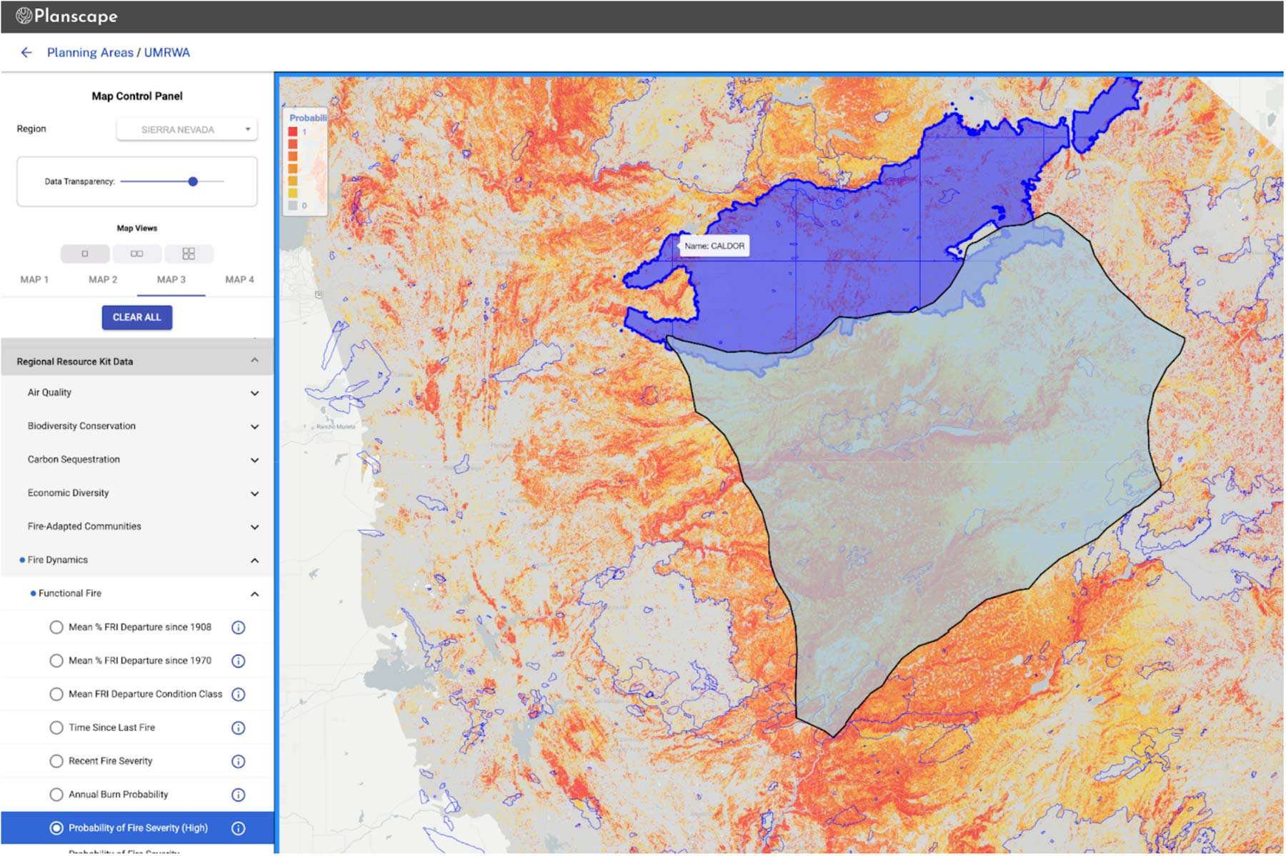
The team is building on top of the Regional Resource Kits, supplementing with local data where available and desired by the team
Defining and refining the goals of the collaborative, and setting priorities. These include Communities, Infrastructure, Wildlife/ Ecosystems, Economic Assets and Watersheds.
Working through project constraints – slope, costs, access, land ownership, etc
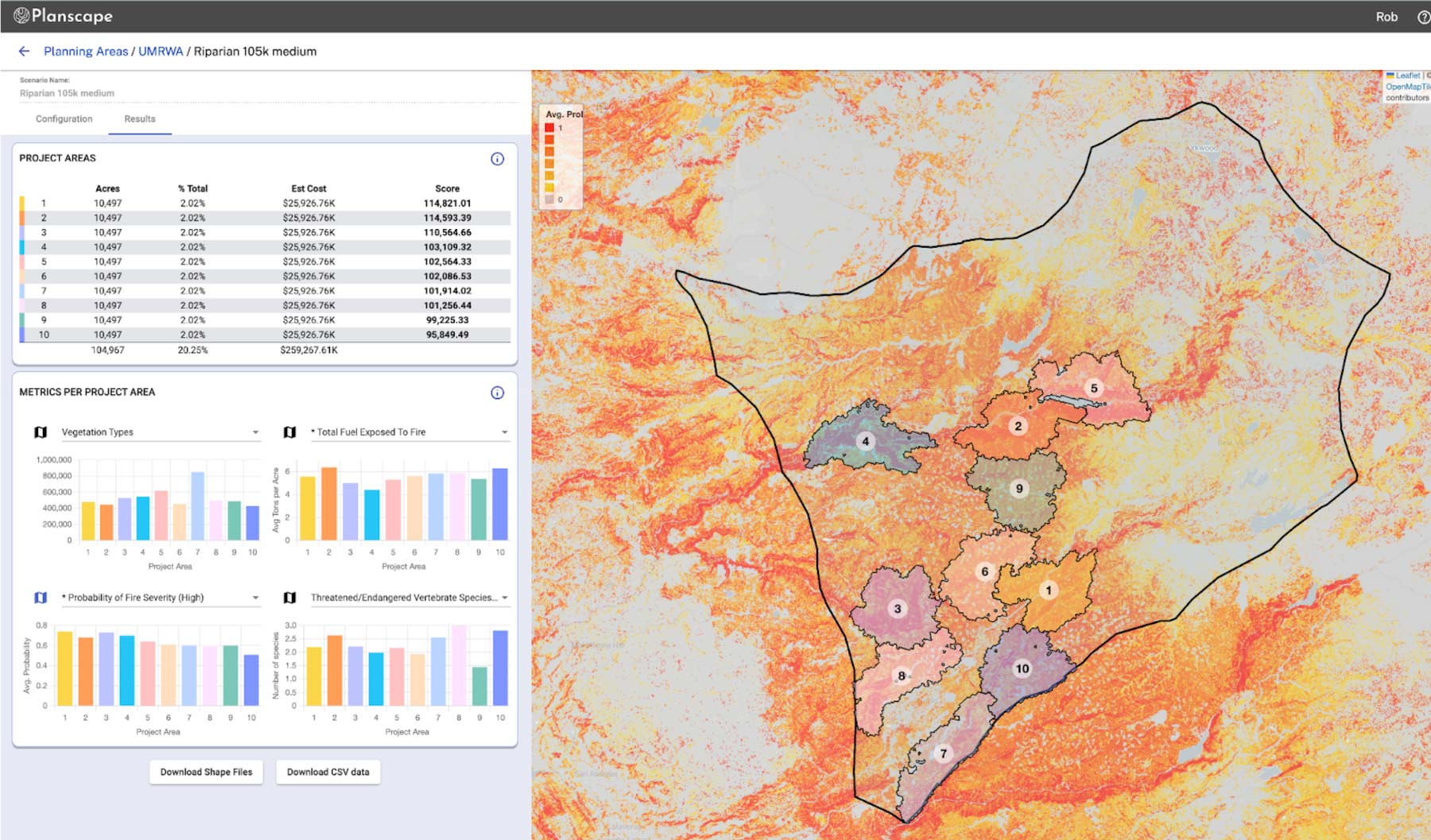
Using the Planscape tool, together with offline analysis, to compare impact of potential treatment areas, defined by the goals and constraints.