We work under the principles of open science. Built on the best, peer-reviewed science. We are not developing new science – Planscape brings best-of-breed tools like ForSys, FVS, Gridfire, Treemap, PROMOTe and others in an easy to use tool through a web browser.
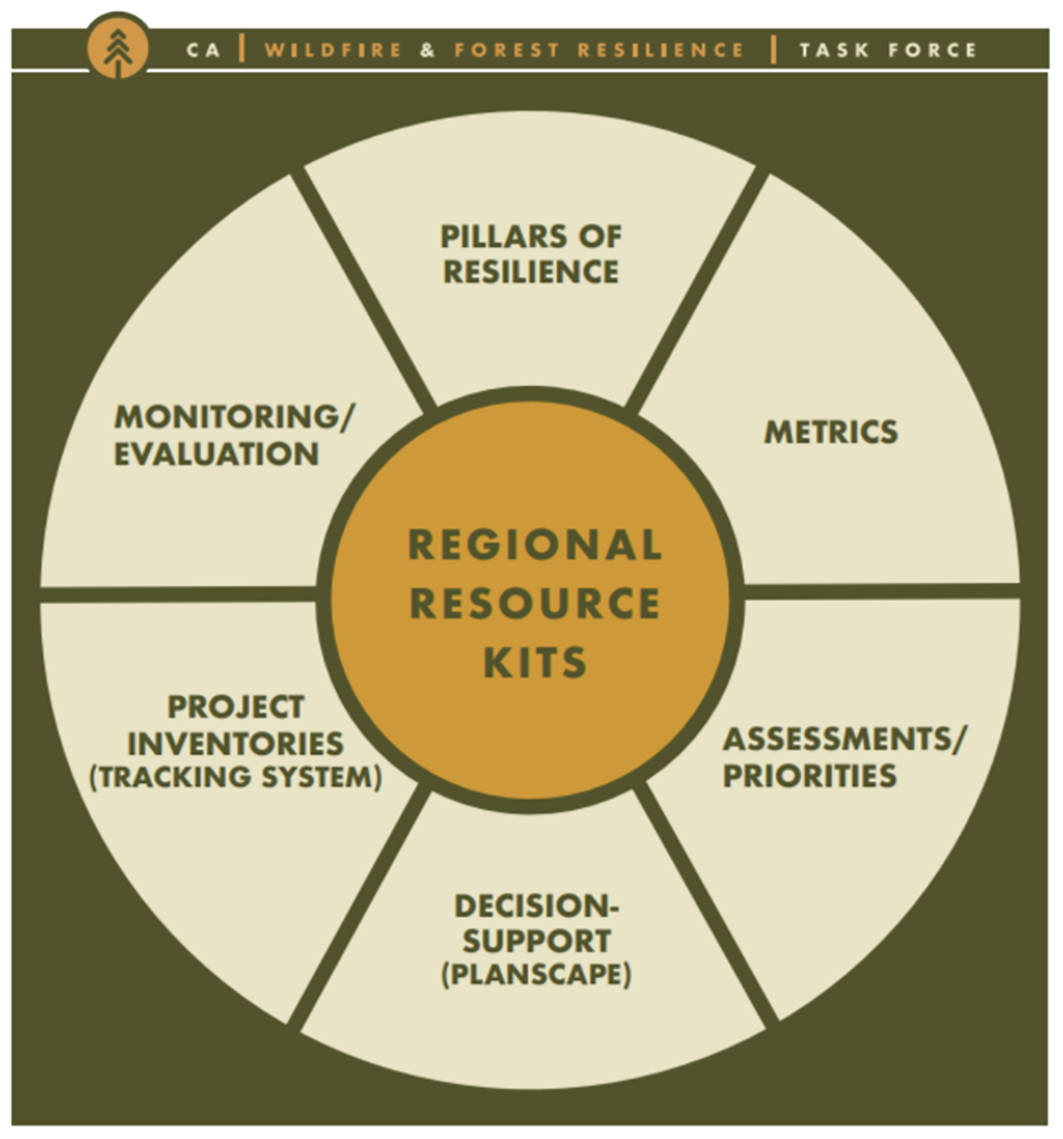
Planscape is built on top of hundreds of GIS based data layers from the Regional Resource Kits (RRKs). The kits are are produced and managed by the Science advisory panel of the Wildfire Taskforce.
Planscape is built on top of hundreds of GIS based data layers from the Regional Resource Kits (RRKs). The kits are are produced and managed by the Science advisory panel of the Wildfire Taskforce.
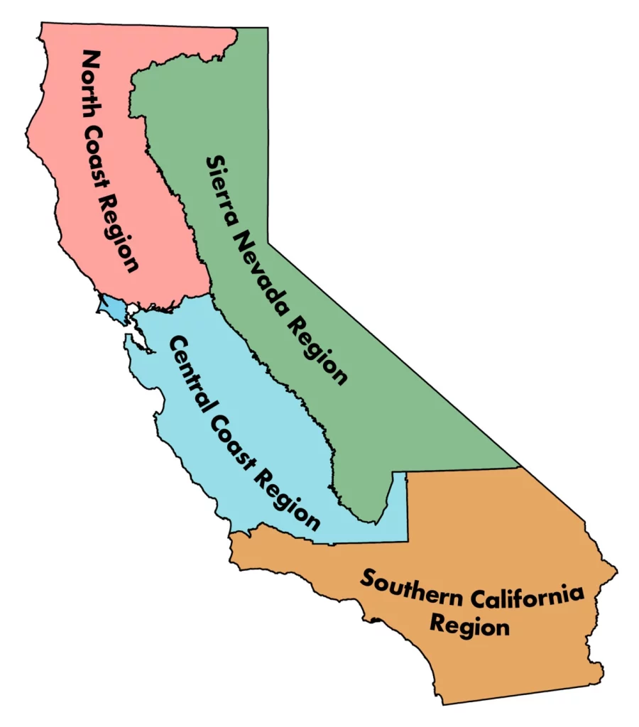
The Regional Profile series is a publicly available resource developed by the Task Force’s Science Advisory Panel. The profiles summarize the socio-ecological context of each region, highlight examples of current condition assessments from the associated Regional Resource Kit, and present findings from interviews and surveys about stakeholder priorities and concerns for community and ecosystem resilience.
The Regional Profile series is a publicly available resource developed by the Task Force’s Science Advisory Panel. The profiles summarize the socio-ecological context of each region, highlight examples of current condition assessments from the associated Regional Resource Kit, and present findings from interviews and surveys about stakeholder priorities and concerns for community and ecosystem resilience.

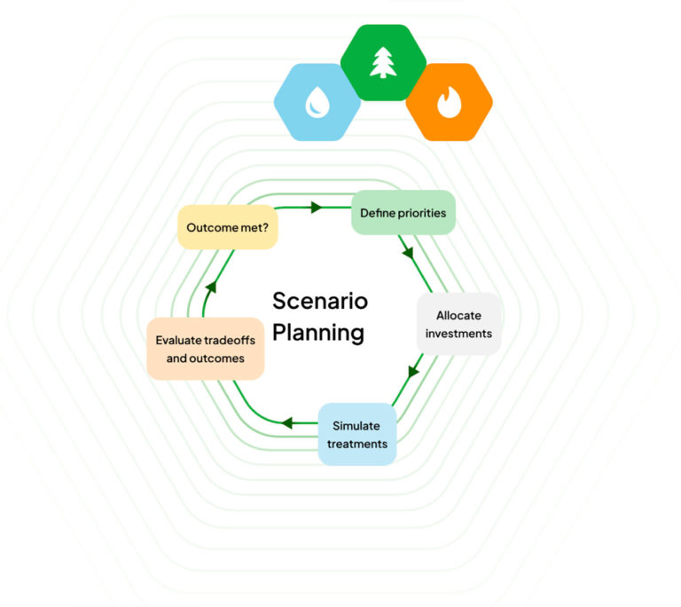
Planscape uses Forsys to help identify optimized projects. Forsys is built and maintained by the USDS Forest Service. ForSys is a flexible platform for exploring landscape management scenarios and optimizing decisions in terms of where and how to achieve landscape restoration and fuel management goals. The model is spatially explicit and uses multi-criteria prioritization and optimization created to rapidly design fuel treatment and restoration scenarios.
Planscape uses Forsys to help identify optimized projects. Forsys is built and maintained by the USDS Forest Service. ForSys is a flexible platform for exploring landscape management scenarios and optimizing decisions in terms of where and how to achieve landscape restoration and fuel management goals. The model is spatially explicit and uses multi-criteria prioritization and optimization created to rapidly design fuel treatment and restoration scenarios.
Feb 1, 2025
Planscape vegetation dynamics in forests are modeled in a growth and yield framework using the Forest Vegetation Simulator (FVS; USDA Forest Service). Vegetation dynamics are modeled spatially by utilizing the USFS TreeMap product, a spatial model which includes cell-level information on forest characteristics at a 30 m resolution (Riley et al. 2021). TreeMap data include a list of trees (with tree species, DBH, height, and live or dead status) and summary information including forest type, number of live and dead trees, biomass, and carbon. TreeMap conditions are current to 2016 and are grown out within FVS to the modeling starting year (2024). Starting conditions currently incorporate disturbances (wildfire or harvest) that occurred between 2016 and 2022 and are available in public databases, including the CNRA Interagency Tracking System, the USDA Forest Service FACTS database, and other federal agency databases.
Pre-treatment forest and non-forest surface fuels are represented by the 40 Scott and Burgan fire behavior fuel models (FM40; Scott and Burgan 2005). The FM40 surface fuel model represents distinct distributions of fuel loading found among surface fuel components (live and dead), size classes, and fuel types. These are associated with differing fire behavior regimes. The FM40 layer used for baseline conditions are derived from LANDFIRE 2.3.0 (representing 2022 conditions). Areas within fire perimeters which burned January 2022-November 2023 were updated to reflect disturbed surface fuel conditions.
Impacts of treatments on non-forest surface fuels are modeled using the disturbance logic encoded in the LANDFIRE Total Fuel Change Tool (LFTFCT), which estimates post-treatment surface fuel characteristics to support comprehensive treatment analysis.
All modeling uses a 30m resolution.
Treatment types were developed in cooperation with land managers to represent the most relevant treatments that are likely to be applied in forested and non-forested systems with the goal of reducing fuel loading and wildfire likelihood and severity.
FVS simulations are parameterized by keyword component files (kcps). Kcps provide information on treatment prescriptions, treatment timing, and other model inputs, which ensure consistency across runs. Planscape models nine treatment prescriptions and eight sequenced treatment prescriptions with stand reentry after 10 years (see treatments list here and details in Table 1 below). Thinning treatments, with the exception of mastication, are followed either by biomass removal or pile burning in the same year or prescribed fire simulated in the subsequent year of treatment.
The single-year treatment prescriptions within Planscape follow prescriptions used by the CalFire Forest Health Grant Program to determine carbon consequences of treatments over time. The Planscape treatment kcps can be viewed here and are described in Table 1 below. The kcps include information on treatment timing, relevant weather conditions for burning, and cutting prescriptions.
Within the current Planscape release 25.02.12, Year 0 treatments are modeled as being implemented in 2024 and Year 10 treatments are implemented in 2034. Planscape shows treatment impacts immediately following treatment and at 5-year intervals thereafter.
Table 1. Brief descriptions of treatment prescriptions included in Planscape. Full kcps can be found here.
Treatment type | Treatment details |
Moderate thinning and biomass removal |
|
Heavy thinning and biomass removal |
|
Moderate thinning and pile burn |
|
Heavy thinning and pile burn |
|
Moderate mastication |
|
Heavy mastication |
|
Prescribed fire |
|
Heavy thinning and prescribed fire |
|
Mastication and prescribed fire |
|
For each of the treatment types, FVS runs were set up for each of the potential treatment years (2024 and 2034). From each of the treatment type-treatment year runs, five timepoints were extracted: 2024, 2029, 2034, 2039, 2044. The timepoints were extracted for all FVS outputs. The output variables are detailed in Table 2.
Table 2. FVS modeling outputs for treatment impacts. Results shown in Planscape are unitless because only the change (Δ) from baseline for each timestep is shown.
FVS modeling output | Description |
Crown Bulk Density | the weight of the crown per unit volume |
Canopy Base Height | the average height above the ground where the tree crowns begin. |
Canopy Cover | the percentage of the ground covered by the vertical projection of the tree crowns. |
Large Tree Biomass | the amount of woody material (weight or volume) contained in trees above a certain size threshold. This threshold can vary depending on the forest type and management objectives |
Merchantable Biomass | the weight of the stem and branches of a tree that can be used for lumber or pulp. |
Non-merchantable Biomass | the weight of the other parts of a tree, such as the leaves, needles, and roots. |
Mortality | the number of trees that die in a stand. |
Potential Smoke | the amount of smoke that could be produced by a fire in a stand. |
Probability of Torching | the likelihood that a tree crown will ignite and burn intensely. Canopy Base Height, Canopy Bulk Density, Fuel Moisture and Fire Intensity all impact the output of the probability of torching. |
Quadratic Mean Diameter | the average diameter of the trees in a stand, calculated by taking the square root of the average of the squared diameters of the trees. |
Stand Density Index | a measure of the number of trees per acre. |
Total Height | the height of the tallest tree in a stand. |
Total Flame Severity | a measure of the intensity of a fire in a stand. |
Total Carbon | the amount of carbon stored in a stand. |
In addition to the outputs listed in Table 2, rate of spread (ROS) and flame length (FL) were assigned for each cell based on the FM40 class based on values encoded in the BehavePlus6 fire modeling software.
Per Scott and Burgan (2005; RMRS-GTR-153), spread rates and flame lengths are referred to as being very low, low, moderate, high, very high, and extreme—assuming two-thirds cured herbaceous, dry dead fuels (moisture scenario D2L2), a midflame wind speed of 5 mi/h, and zero slope (Table 3).
Table 3. Adjective classes for ROS and FL (Source: RMRS-GTR-153, Table 5).
Adjective Class | ROS (ch/h) | FL (ft) |
Very Low | 0-2 | 0-1 |
Low | 2-5 | 1-4 |
Moderate | 5-20 | 4-8 |
High | 20-50 | 8-12 |
Very High | 50-150 | 12-25 |
Extreme | > 150 | > 25 |
To model nonforest (shrub and grass fuel types) treatment impacts, we encoded the three-digit disturbance code needed to crosswalk the pre-disturbance fuels to post-disturbance fuels based on the treatment type. The LFTFCT disturbance code includes three elements: type of disturbance, severity of disturbance, and time since disturbance. We then use the LFTFCT master lookup table applied to unique combinations of the LANDFIRE zone, the disturbance code, biophysical Settings (BPS), fuel vegetation cover (FVC), fuel vegetation height (FVH), and fuel vegetation type (FVT) to derive the post-treatment FM40 class. This was completed using an automated workflow in Google Earth Engine.
Non-forest models are assigned a pre-treatment ROS and FL adjective class as well as post-treatment classes for reclassified FM40 following treatment when applicable according to the LFTFCT.